
PNT: Going Beyond GPS

By Thomas Reed, Bliley Technologies
The most important thing a soldier must maintain on the battlefield is situational awareness: the ability to identify and understand what is happening around you and how it pertains to the mission. Over the past few decades, Global Positioning System (GPS) technology has become an integral tool for helping U.S. forces stay aware of their surroundings.
While the origins of this technology can be traced back to the 1950s, it wasn’t until the Persian Gulf War in 1991 that GPS made its first real battlefield debut, and it played a significant role in bringing about the rapid U.S. victory.
GPS is a form of positioning, navigation, and timing (PNT) technology, and it allows military forces to accurately pinpoint their location and plan their movements. Knowledge of the environment and where one is headed provide the context in which decisions are made. Over time, GPS technology was adopted for commercial purposes, and it now is widely used by the public for personal navigation, as well as in the commercial aviation sector.
But, as powerful as GPS technology is, it has three problems: First, GPS coverage isn’t always available, and the signals can be jammed. Second, the accuracy of GPS signals can be problematic when dealing with vertical locations and varied elevation (this presents a significant problem for UAVs, for instance).
Finally, leaders in the Department of Defense (DoD) are concerned about overreliance on a single technology. If GPS guidance becomes unavailable, soldiers and drones in the battlefield could essentially be left blind, unable to navigate. If that awareness is lost, even for a minute, the consequences can be disastrous. GPS also plays an important role in targeting and guidance systems for misses. As such, GPS has become both a strength and a vulnerability.
To overcome these problems, new PNT systems are being developed that can enhance the effectiveness of existing GPS, and take advantage of alternatives to conventional GPS.
GPS And The Rest
Of course, the term GPS applies primarily to the satellite navigation system developed by the U.S. There exist other PNT systems, set up by governments around the world, and a number of emerging technologies that will change the way PNT systems operate in the future. Together, these systems are referred to as the Global PNT System of Systems (GPSS).
The U.S.-built GPS system already has been mentioned; afterward came GLONASS (Russia), Beiduo (China), and Galileo (European Union). India recently launched the final satellite, its own regional PNT called Indian Regional Navigation Satellite System (IRNSS). It, too, will be incorporated within the GNSS.
As you can see, the U.S. certainly has no monopoly on advanced PNT technology. Use of foreign GNSS may be an option in some scenarios, but for security purposes, the U.S. military could never depend solely on these as the bedrock for upgrading its PNT capabilities. As more nations develop their own navigation systems, different technologies are being developed to help the U.S. military and others maintain a competitive advantage in PNT.
Augmenting GPS
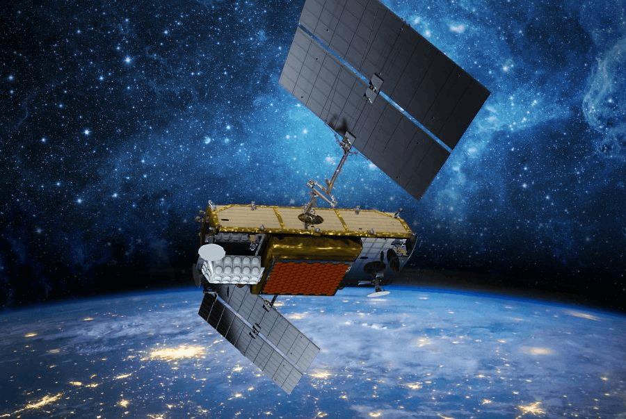
The most obvious step is to upgrade what already is in place. GPS III is a next-gen form of GPS being developed by the U.S Air Force and Lockheed-Martin. The system is based on new GPS Block IIIA satellites, which include sophisticated anti-jamming features and allow accuracy up to three times greater than that of GPS satellites currently in use. The first satellites in the GPS IIIA-1 series are scheduled for launch in 2018.
Both GPS III and older GPS systems will continue to form the foundation of the GPSS for many years to come, but newer technologies and separate, terrestrial systems are being developed which will augment the effectiveness of currently-existing PNT systems.
One solution is ground-based augmentation systems (GBAS). These are surface-based systems that enhance the abilities of space-based PNT over specific local geographical areas. At present, GBAS is used primarily in civilian air traffic control applications, and it plays an important role in precision approach operations, such as landings.
Ground-based PNT systems (GBPS) also play a key role in enhancing and strengthening PNT capabilities. GBPS is separate from a GNSS network, but they are time- and geo-referenced to GNSS, boosting the overall accuracy and effectiveness of satellite PNT networks.
![]()
Hybrid and Autonomous PNT Systems (HAPS) represent a broader selection of solutions to the challenge of improving PNT capabilities. The aforementioned re-tasking of cellular and other networks to cover gaps in the “vision” of GPS represents a hybrid PNT. This is just one example; many “alternate-frequency” PNT methods can be developed to produce more accurate and consistent coverage.
The ultimate goal is to have a completely autonomous PNT source within a device or vehicle, one that doesn’t require positioning and timing from external sources, but still offers PNT at the same or higher quality than existing systems. Such a system is many years away, to be sure, but new technology — like chip-scale atomic clocks and micro-electromechanical systems internal measurement units (MEMS-IMU) — offers a glimpse at how an autonomous PNT source might one day come to fruition.
Feature mapping and visualization tech also could make this happen, but it would require a huge feature and terrain database built right into the PNT device, and would have to be regularly updated with real-time information.
Autonomous PNT may be a distant dream for now, but until they arrive, GPS III, GBAS, and terrestrial hybrid systems offer promising alternatives to traditional GPS for enhancing situational awareness and achieving mission success.
About The Author
Tommy Reed is VP of Technology for Bliley Technologies, applying lean startup and design thinking methodology to future proof Bliley. He has led R&D programs for several years, most recently with Harris Corporation's Electronic Systems Segment. Reed defines the technology strategy that will propel Bliley into its next chapter of solutions while balancing a research portfolio that is yielding orders of magnitude performance improvements over current industry standards.